EPIC.awi.de
Items where Author is "Seitz, Florian"
Group by: Item Type | No Grouping
Jump to: Article | PANGAEA Documentation
Number of items: 8.
Article
Article
Müller, F. L. , Wekerle, C. , Dettmering, D. , Passaro, M. , Bosch, W. and Seitz, F.
(2019)
Dynamic ocean topography of the northern Nordic seas: a comparison between satellite altimetry and ocean modeling ,
The Cryosphere,
13
(2),
pp. 611-626
.
doi:https://www.doi.org/10.5194/tc-13-611-2019
, hdl:10013/epic.32ec6650-5529-4798-b9db-a5448e6e9d5f
Article
Müller, F. L. , Dettmering, D. , Wekerle, C. , Schwatke, C. , Passaro, M. , Bosch, W. and Seitz, F.
(2019)
Geostrophic currents in the northern Nordic Seas from a combination of multi-mission satellite altimetry and ocean modeling ,
Earth System Science Data,
11
(4),
pp. 1765-1781
.
doi:https://www.doi.org/10.5194/essd-11-1765-2019
, hdl:10013/epic.432fdc2a-ea25-4f1b-961e-f5caa7ab16d0
PANGAEA Documentation
PANGAEA Documentation
Seitz, F.
(2015)
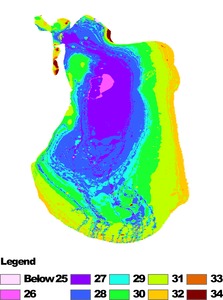
Updated bathymetric chart of the East Aral Sea, overview map ,
Bremerhaven,
PANGAEA
.
hdl:10013/epic.46456
PANGAEA Documentation
Seitz, F.
(2014)
Documentation of GPS measurements at station BREI ,
Bremerhaven,
PANGAEA
.
hdl:10013/epic.43862
PANGAEA Documentation
Seitz, F.
(2014)
Documentation of GPS measurements at station HRIE ,
Bremerhaven,
PANGAEA
.
hdl:10013/epic.43868
PANGAEA Documentation
Seitz, F.
(2014)
Documentation of GPS measurements at station WART ,
Bremerhaven,
PANGAEA
.
hdl:10013/epic.43869
PANGAEA Documentation
Seitz, F.
(2014)
Documentation of GPS measurements at station FAHR ,
Bremerhaven,
PANGAEA
.
hdl:10013/epic.43866
PANGAEA Documentation
Seitz, F.
(2014)
Documentation of GPS measurements at station HGRA ,
Bremerhaven,
PANGAEA
.
hdl:10013/epic.43867
![[up]](/style/images/multi_up.png) Up a level
Up a level![[thumbnail of bathy_east.png]](https://epic2-clone.awi.de/39268/1.hassmallThumbnailVersion/bathy_east.png)


